Search Results
Showing results 1 to 4 of 4
Tropical Belt
Source Institutions
This lesson familiarizes learners with the term "tropical belt." First, learners locate the equator, Tropic of Cancer and Tropic of Capricorn on a map and trace these lines with a crayon.

Energy Use in the Americas
Source Institutions
Learners explore the relationship between energy consumption, population, and carbon emissions in the countries of the Americas.
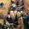
Where in the World is the Terra Cotta Army?
Source Institutions
In this activity, learners find Xi'an, the archaeological area in China where the Terra Cotta Army was discovered, on a map or globe and look more closely at the relationship of the warrior site to ot
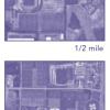
Aerial Imagery
Source Institutions
This activity (on page 2 of the PDF under SciGirls Activity: Earthquakes) is a full inquiry investigation into aerial imagery.