Search Results
Showing results 21 to 35 of 35
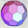
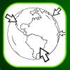
Using Different Models of Earth
Source Institutions
In this activity, learners explore how the shapes, sizes, and distances of land masses appear differently on two different models of Earth: an icosahedron and a flat map.
Supernova Star Maps
Source Institutions
This fun astronomy activity allows learners to experience finding stars in the night sky that will eventually go supernova. This activity is perfect for a star party outdoors.
Map That Habitat
Source Institutions
Historically, sea floor mapping (bathymetry) was done by soundings.
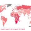
Mapping the Spread of HIV/AIDS: Trailing the Pandemic
Source Institutions
In this activity, learners act as epidemiologists by mapping the prevalence of HIV/AIDS worldwide.
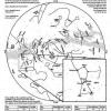
Drawing Conclusions
Source Institutions
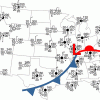
In this weather forecasting activity, learners determine the location of cold and warm fronts on weather plot maps.
Green Travelers
Source Institutions
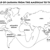
In this activity (on pages 23-29), partners use the Plant Traveler Cards, along with a world map and map worksheets, to follow plants such as cassava, chocolate and coffee that grew first in one part
Forward Thinking
Source Institutions
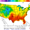
In this activity, learners create their own weather forecast map.

Energy Use in the Americas
Source Institutions
Learners explore the relationship between energy consumption, population, and carbon emissions in the countries of the Americas.
If Anyone Can, Icon
Source Institutions
In this activity, learners create their own icons for a forecast-at-a-glance poster for their classroom/learning space.
Where on Earth?
Source Institutions
Learners look at labels on items in the room to determine where each item was manufactured, then write about the item on an index card.
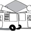
Tourist Town: Dominating Sets
Source Institutions
In this activity, learners use a fictitious map of "Tourist Town" and counters to problem solve how to place ice-cream vans on street intersections so that every other intersection is connected to one
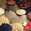
Spice World
Source Institutions
In this activity, learners create a map showing the origins of spices and herbs from a favorite recipe(s). Learners first research the origins of the ingredients and then locate them on a world map.
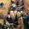
Where in the World is the Terra Cotta Army?
Source Institutions
In this activity, learners find Xi'an, the archaeological area in China where the Terra Cotta Army was discovered, on a map or globe and look more closely at the relationship of the warrior site to ot
Aerial Imagery
Source Institutions
This activity (on page 2 of the PDF under SciGirls Activity: Earthquakes) is a full inquiry investigation into aerial imagery.
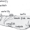
Habitats of the Pond
Source Institutions
In this outdoor activity/field trip, learners locate and study plants and animals in several freshwater pond habitats.